
Mitchell River and Snowy River - 27th December to 31st December 2004
Snowy River National Park
Day 5 - 31st December 2004
Another lovely warm day awaited us on our last day in the high country. Better make the most of it!
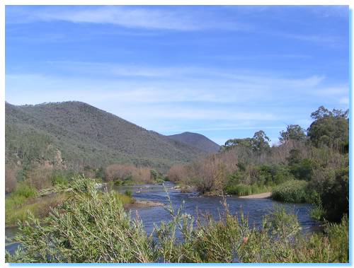
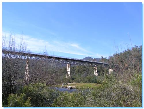
We explored around McKillops Bridge, walking down under the bridge to the sides of the Snowy. Three young Kookaburras played on a tree branch above.
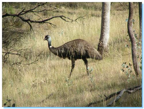
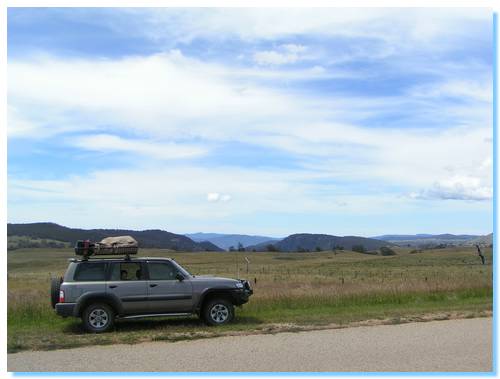
We'd caught a number of small scorpions at the campground, and even a tick which I spotted luckily before it decided to have a go at one of us. Now there were emus along the roadside!
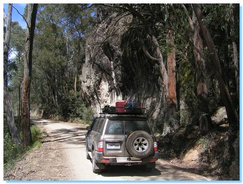
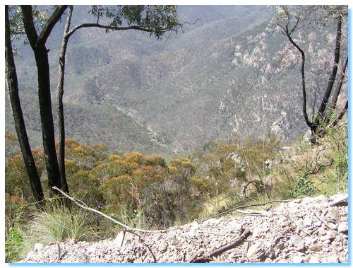
The 4WD track down to the campsite where the Little River joins the Snowy offered some great views, as well as some fun 4WDing with some steep descents back down to the river. The campsite was quite nice, and there were a few groups camped down here.
As we climbed out of the valley, something on the side of the steep hills kept catching the sun. It looked like a car had run down the mountain side. As we drew closer to Turnback, we parked the car and went to investigate. It was only an old car that had been pushed over the edge, eventually coming to rest against a tree. At least we hope so. There was little chance of walking down and back up as the slope was far too steep!
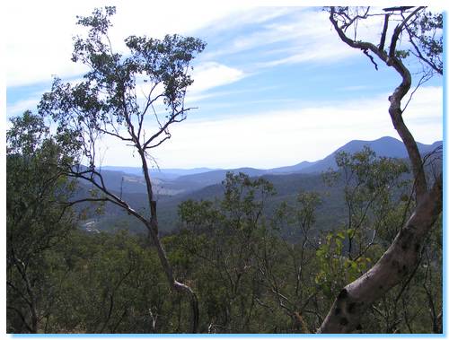
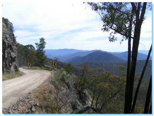
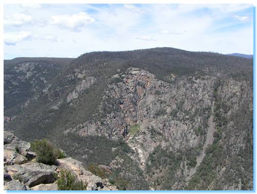
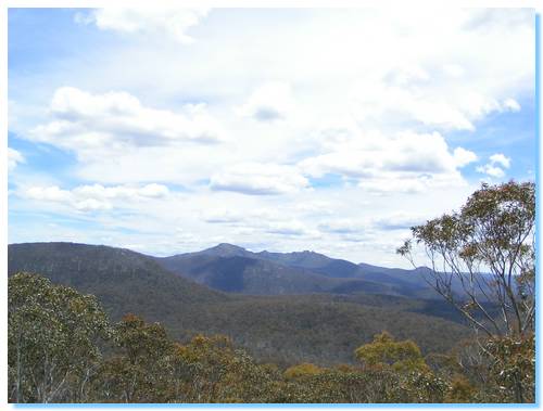
The road brought us past rocky outcrops as it reached it's highest point, and we were now travelling alongside Little River Gorge. This is Victoria's deepest gorge, the bottom lying some 305 metres almost straight down off the side of the road.
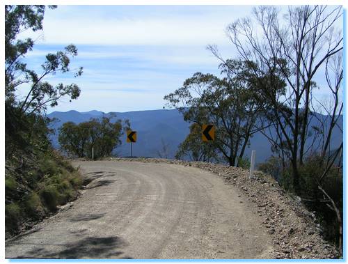
Notice how there are no safety rails? Make sure you take the turn!
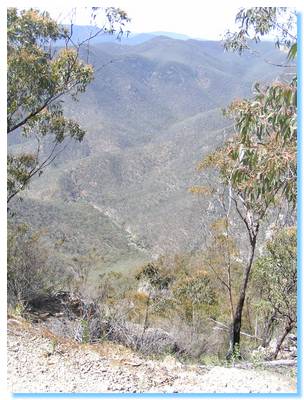
It's a long way straight down. 305 metres to be exact.
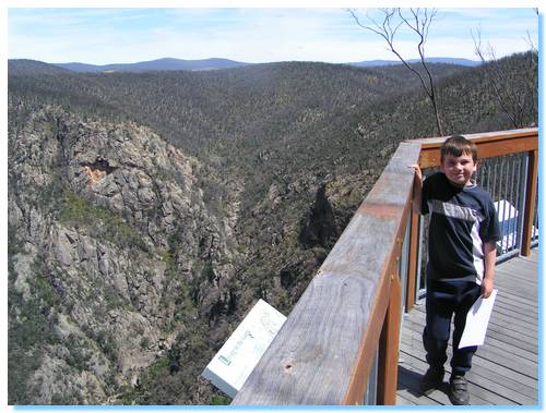
Further along there is a viewing platform, which either survived the 2003 Alpine Fires, or has since been rebuilt. We used the GPS to find the lookout platform, as we were also looking for a geocache here. Doing it this way took us the wrong way down, leaving us navigating the platform from the other side, a little scary but still fairly safe. I suppose the signs indicating the proper walking track (which we followed on the way back) were victims of the fires.
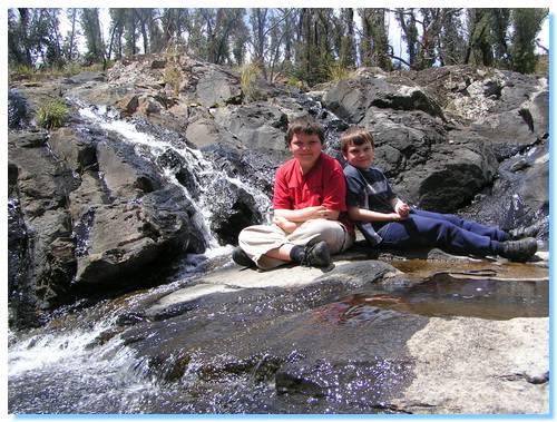
Further along the road brought us to the top of the gorge, and the Little River Falls. The perfect spot to relax and cool off on a hot January day!
We drove into Seldom Seen, but it had been devasted by the fires. "Dave" had survived but not much else, by sheltering in the dam nearby with his dog as everything burned around.
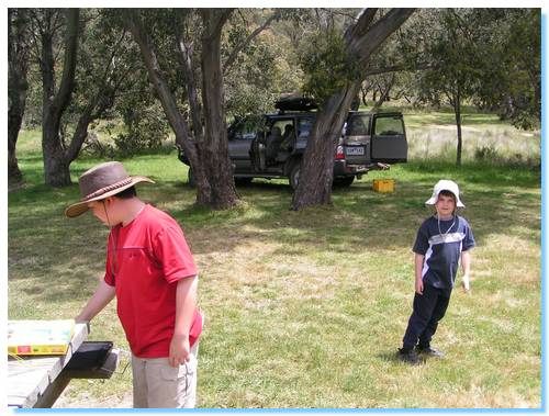
Native Dog campground is a lovely spot on the upper reaches of the Buchan River. We stopped here for lunch (some tasty Fajitas, another camp food favourite of me and the kids) when another Patrol towing a T-Van arrived. A quick chat and I was further sold on the idea I've got to get me one of those...
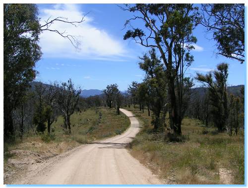
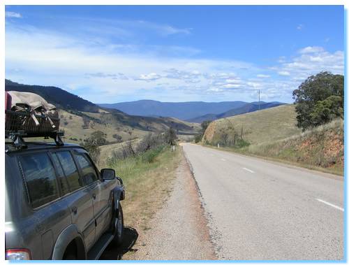
It was starting to be time to head on home. We drove across the tops of the High Country, passing snakes on the road, beautiful views of the Cobberas (to be explored further next year) and lovely little mountain towns. We bought icecreams in Benambra and followed the Tambo back out of the mountains.
| Track Name | Surface | Travel Time | Total Distance | Avg Speed | Min Alt | Max Alt |
| Home to Warragul | Sealed/Freeway | 1 hour 29 minutes | 110km | 74km/hr | 37 metres | 173 metres |
| Home to Moe Turnoff | Sealed/Freeway | 1 hour 46 minutes | 138km | 78km/hr | 37 metres | 173 metres |
| Home to Traralgon | Sealed/Freeway | 2 hours 7 minutes | 170km | 80km/hr | 37 metres | 173 metres |
| Home to Sale | Freeway/Highway | 2 hours 42 minutes | 220km | 81km/hr | 18 metres | 173 metres |
| Home to Mitchell River NP (Hunter Corner) | Freeway/Highway | 3 hours 30 minutes | 283km | 75km/hr | 18 metres | 260 metres |
| Hunter Corner to Den of Nargan Picnic Area | 2WD Gravel | 5 minutes | 4.6km | 62km/hr | 191 metres | 264 metres |
| Den of Nargan to Amphitheatre | 2WD Gravel | 16 minutes | 9.4km | 34km/hr | 183 metres | 255 metres |
| Amphitheatre to Angusvale(Mitchell Road) | 4WD Easy. 1 small creek crossing | 51 minutes | 20km | 24km/hr | 101 metres | 461 metres |
| Angusvale Turnoff (Dargo Rd) to Angusvale | 2WD Gravel | 25 minutes | 16.4km | 40km/hr | 111 metres | 526 metres |
| Hunters Corner to Angusvale | 2WD Gravel/Sealed | 9 minutes | 9.7km | 67km/hr | 292 metres | 478 metres |
| Hunters Corner to Bairnsdale | Highway | 38 minutes | 40km | 62km/hr | 21 metres | 291 metres |
| Bairnsdale to Lakes Entrance | Highway | 41 minutes | 37km | 54km/hr | 10 metres | 92 metres |
| Lakes Entrance to Nowa Nowa | Highway | 15 minutes | 22km | 87km/hr | 9 metres | 100 metres |
| Nowa Nowa to Lake Tyers Rd turnoff | Highway | 4 minutes | 6.5km | 93km/hr | 22 metres | 94 metres |
| Lake Tyers Rd to Beach campsite | 2WD Gravel | 15 minutes | 15.9km | 62km/hr | 13 metres | 87 metres |
| Lake Tyers to Highway via Old orbost Rd | 2WD Gravel, lots of wallabies | 25 minutes | 19km | 46km/hr | 3 metres | 76 metres |
| Newmerella to Tulloch Ard Rd Turn off | Sealed Highway | 50 minutes | 50km | 60km/hr | 13 metres | 260 metres |
| Buchan Orbost Rd to Balley Hooley Camping Area | 2WD Gravel | 17 minutes | 15.9km | 62km/hr | 13 metres | 87 metres |
| Tulloch Ard Rd to Running Creek Tk exit | 2WD Gravel | 27 minutes | 20.5km | 45km/hr | 294 metres | 765 metres |
| Running Creek Tk to Jacksons Crossing | 4WD with some steep sections and river crossing | 33 minutes | 9km | 16km/hr | 75 metres | 780 metres |
| Jacksons Crossing to Yalmy Tk | 4WD Clay | 25 minutes | 11.8km | 28km/hr | 86 metres | 381 metres |
| Yalmy Tk to Deddick Trail | 2WD Gravel | 40 minutes | 30.3km | 45km/hr | 180 metres | 765 metres |
| Deddick Trail | 4WD, beautiful scenery, steep ascents and descents, creek crossings, alpine ridges | 2 hours 40 minutes | 51.5km | 19km/hr | 230 metres | 1205 metres |
| McKillops Bridge to Little River Camp exit | 2WD Windy Gravel | 16 minutes | 7.1km | 26km/hr | 193 metres | 280 metres |
| Little River Camp Track (One Way) | 4WD Gravel, steep descents | 12 minutes | 3.2km | 16km/hr | 189 metres | 369 metres |
| Little River Exit to Little River Gorge | 2WD Gravel, wibndy with steep precipaces | 22 minutes | 8.8km | 24km/hr | 347 metres | 899 metres |
| Little River Gorge exit to Seldom Seen | 2WD Gravel/bitumen | 35 minutes | 12.8km | 22km/hr | 805 metres | 940 metres |
| Seldom Seen to Native Dog Camping Area | 2WD Gravel | 1 hour 46 minutes | 55.3km | 31km/hr | 805 metres | 1443 metres |
| Native Dog Camping Area to Benambra | 2WD Gravel/Sealed | 50 minutes | 47.2km | 57km/hr | 715 metres | 1289 metres |
| Benambra to Omeo | Sealed | 23 minutes | 23.3km | 61km/hr | 622 metres | 941 metres |
| Omeo to Swifts Creek | Highway | 19 minutes | 26km | 82km/hr | 300 metres | 766 metres |
| Swifts Creek to Tambo Crossing | Highway | 30 minutes | 36.4km | 73km/hr | 158 metres | 399 metres |
| Tambo Crossing to Bruthen | Highway | 30 minutes | 33.6km | 66km/hr | 47 metres | 330 metres |
| Bruthen to Bairnsdale | Highway | 20 minutes | 26.3km | 78km/hr | 18 metres | 130 metres |
| Bairnsdale to Home | Highway/Freeway | 3 hours 16 minutes | 286.4km | 88km/hr | 19 metres | 179 metres |