
Mt Tanglefoot Walk - 15th January 2005
Notes on this walk can be obtained from the DSE Page at this location.
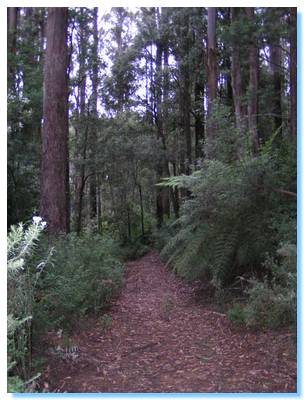
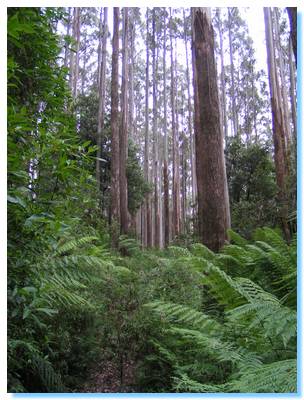
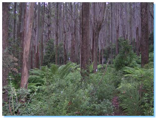
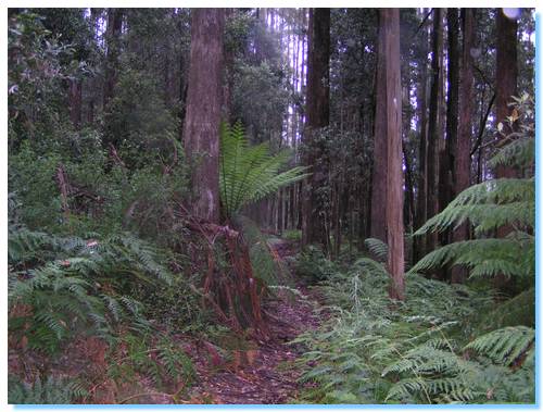
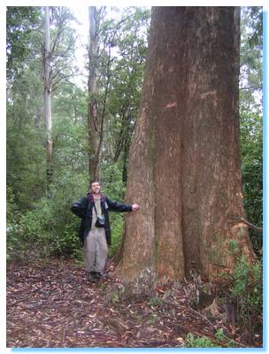
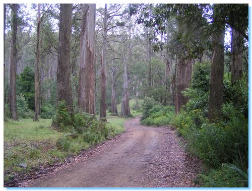
Mt Tanglefoot is located in the Black Ranges, just north of the township of Toolangi. The forest is predominately tall Mountain Ash with a tree fern understory and is typically wet. Hence the name rainforest!
Today the forest lived up to it's name, and a light drizzle fell on a number of times throughout our walk.
We started at the Mt Tanglefoot Carpark shortly after 9:30, climbing gently along the western slope of Mt Tanglefoot through the towering Mount Ash (Eucaluyptus Regans).
The initial stages of the walk were along a wide track that had been cleared by a bulldozer. However it wasn't long before the path narrowed and was eventually overgrown, forcing us to push our way through the wet undergrowth. I was very quickly soaked through.
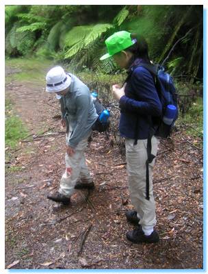
About an hour or so into the walk we picked up our first leech. I started to count them, but it soon became apparent that the sheer number was beyond reckoning. At some points through the walk, we were unable to pick them off quicker than they would climb onto us so we just had to keep moving.
I learnt a lot about leeches on this walk though. Here are my leech tips:
- Leeches are mostly on the ground, especially in the wetter areas, like near creeks and gullies. If there is a lot of leaf litter and it is wet, then there will be a lot of leeches!
- Leeches are actually of medical benefit.
- A leech bite is generally painless, won't carry any diseases but can itch afterwards. Unlike mosquitos which can carry some very nasty diseases!
- The leech bite will bleed for some time after the leech drops off. This is due to the anticoagulants.
- Most leeches are on the ground, and get onto you via your shoes. Insect repellant on your shoes with your trousers tucked into your socks will act as a very effective (though fashion challenged) barrier.
- There can be infection caused by the leech's gut bacteria. Irritation or infection from mouth parts left after forcible removal is debatable.
- Leeches usually won't harm you, unless you're allergic to them. They are just very iccy and creepy.
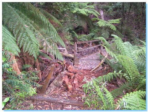
At one point along the walk, a huge tree had collapsed crushing the timber walkway over a small creek. The tree had appeared to have exploded, with only shattered fragments now remaining.
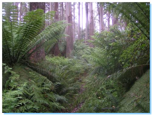
At some points along the walk, the ferny undergrowth was so thick it was like walking through a sea of green. This is were we got the wettest. My clothes couldn't have been wetter if I had jumped fully clothed into a swimming pool. My waterproof shoes were filling with water that was running down my trouser legs!
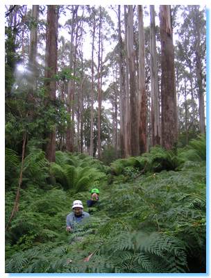
The halfway point was where the Tanglefoot Track joined with Mondo Road, and we reached this after 3 hours of walking; on par with the guide notes. This is an absolutely beautiful road, and I'd driven along here before. The undergrowth is cleared to act as a fire break, leaving the tall mountain ash standing on the grassy verge. A lovely place for a picnic on a warm day, but with a light rain falling we continued on, eating our lunch on the move.
The walk along Quarry Road was much easier. The road was clear and gently slopped downwards for much of it's length. At one point the road became a creek; I'm not sure if this was the normal state or if there was just a lot of water from the recent and current rain.
One of the scores of leeches was successfull in it's mission, it's only legacy being blood stained trousers.
We reached the quarry in good time, and paused for some snacks before heading into the deep wet jungles of the Myrtle Gully Walk. This was probably some of the most beautiful portions of the walk, with huge Beech Myrtle trees and wet ferny moss covered gullies. But the rain was falling harder and it was too wet to even take photos. This would be very enjoyable on a hot day, as I imagine it would be quite cool here, and the leeches should be fewer between.
We left the gully and climbed back into the mountain ash as we approached our starting point 6 hours and 18 kilometres after leaving this morning. The last hour or so was the hardest, as it was very wet and getting quite cold. A hot cup of tea back at the carpark was perfect to make us feel civilised again!