
Crooked River Cup Weekend November 2004
Participants: Henric, Cory, Michelle, Mark, James & Liam
Saturday 30th October 2004
This is the trip were I learnt that planning out a trip in detail, picking the tracks you wish to travel on, and estimating where you will be camping for the night doesn't match what will happen in reality...
It all started well enough, Henric and Cory were around at our place early on Saturday morning, and the cars were all soon packed ready to go. There was some last minute artistic arrangement of the food into the car fridge, but once we were sure we'd taken advantage of every skeric of space we were off on our travels.
The first alteration to the plan came some hours down the road when the turnoff from Woods Point Road marked clearly on all the maps I have just didn't exist in reality. Reversing, backtracking and double checking eventually showed a small overgrown goat track so we continued along Woods Point Road into Woods Point, and took advantage of the last civilised toilets we expected to see for a little while. Oh, we also took time out to enjoy an ice-cream.
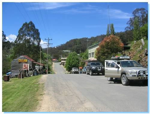
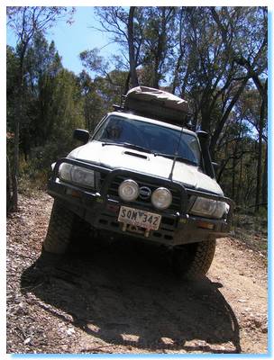
Woods Point is certainly a lovely town worthy of some time, but today we had grander travel plans. Our first bit of 4WDing had us climbing the Old Coach Road. It's hard to imagine horse drawn coaches being dragged up this narrow winding dirt track. We stopped at a switch back near the top to let the air down in the tyres to a safe and comfortable pressure.
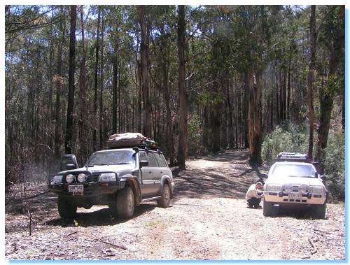
The Old Coach Road joined up with Webber Spur Track at the site of the Mountain Home Hotel. We looked around for any remains of the old hotel, only spotting a bit of rusting iron. There wasn't much left of the sawmill site either as we continued along Webber Spur Track along the ridge top, through a number of shallow bog holes.
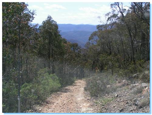
Webber Spur gradually descended, giving us some great views off into the distance before rising again to a helipad where we took a breather and enjoyed the panorama.
The descent from the helipad down Webber Spur was reasonably steep, and the girls decided to walk down, not trusting either the cars or the drivers, or maybe both. Walking down was certainly the harder way of getting to the bottom, and they did call half seriously for us guys to drive back up and pick them up.
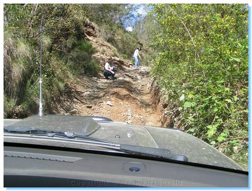
All back in the cars, we passed Baileys mine on the side of the track and continued along what was marked as a walking track on the map, but was clearly an alternate 4WD track, even if a little steep at times.
The nerves of the girls were soon put to the test with the final descent to the Goulburn River. This was very steep, dropping straight down the spur and falling 100 metres in a distance of 280 metres. Something most definately to be avoided in the wet.
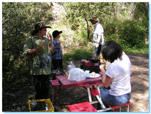
We set up for lunch on the banks of the Goulburn River, enjoying the hot dogs and trying a bit of fishing and gold panning as well as chatting about our journey so far. This was Cory's first 4WD trip, as well the first for a while for Michelle, so there were a few comments about the steep tracks experienced so far.
Given that lunch was about 2:00PM, and we had ommitted a good portion of 4WDing already from the original plan, it was starting to become evident that the anticipated travel time, and the total time expected to be driving before reaching our campsite was grossly underestimated...
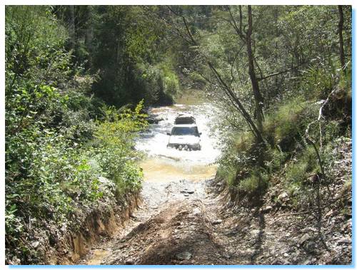
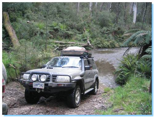
With lunch sorted out and the fishing unsuccessful, we tackled our first (of very many) river crossings on this trip. The Goulburn was quite shallow, and we all made it across easily and up the steep exit on the other side of the river.
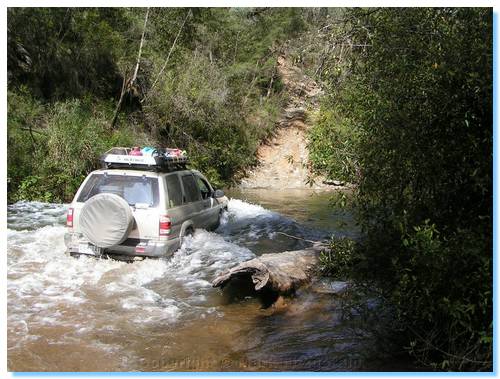
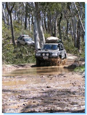
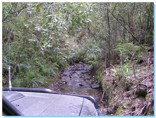
We were now on Champion Spur, which rises quickly between the Goulburn and Black Rivers. The track soon descended again, and take a look again at the picture. Yes, that is us driving up a creek. Now before you get all high and mighty and start spouting about Tread Lightly, the track actually follows the creek. And what a great track it was; driving up the thickly planted creek bed pushing our way through tree ferns we both managed to get stuck. Henric sitting on his diff on a rocky ledge in the middle of the creek which he managed to get over on his own, and myself resting on my step on the rocky creek bank, requiring winching to get over.
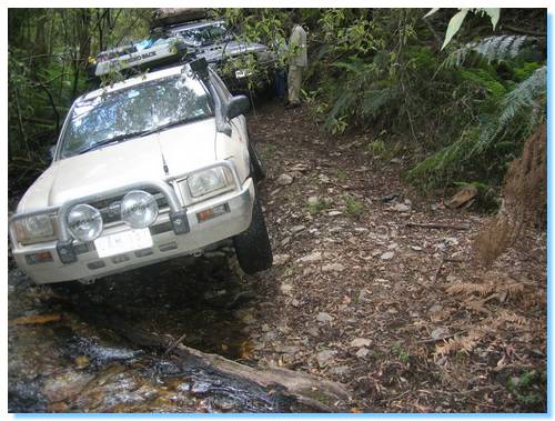
The track continued in the creek bed for a total of over 300 metres and we had just gotten back onto proper dry track when the creek got it's revenge on Henric. He had slipped off the track into the creek at the very last small crossing leaving the back of his car firmly wedged against the drop-off, and the front left wheel a good foot into the air. Clearly the Pathfinder was not going anywhere without recovery. As I was behind with the winch, we hooked up a tree protector and snatch block to a tree in front of Henric and managed to winch him forward and out.
We were now climbing Burnt Camp Spur, which eventually rejoined Champion Spur. Time was passing quickly and it was evident we would not make our planned campsite on the Maccalister River any time before dark.
We considered camping down near the crossing of the Black River, however the descent had been quite steep, and we figured if it rained over night, then we'd pretty well be spending the whole long weekend down here so we continued on, planning to camp at Rumpff Flat on Mount Skene Creek.
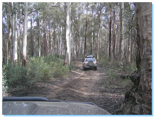
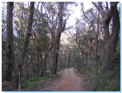
We crossed the Black River and climbed out of the valley, eventually arriving at the heavily logged area near the Heyfield Jamieson Road. The road naming isn't very imaginative here, but at least you know where the road comes from and where it goes too. And it's certainly better named than the N14, N13 N12, N11 and N10 tracks we passed branching off before we turned down McMillan Track! Now we were getting somewhere! This track even had two names, being also known as Morris Road. Though a road it certainly wasn't.
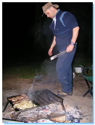
Surprisingly, and despite all expectations we arrived at Rumpff Flat before dark. The place was crowded and so we continued up Middle Ridge Road to avoid the crowds and soon came to a magical grassed and empty secluded spot on a bend of Mount Skene Creek. The perfect campsite. It wasn't long before the tents were up, the fire going and the BBQ sizzling away.
| Track Name | Surface | Travel Time | Total Distance | Avg Speed | Min Alt | Max Alt |
| Home to Healesville | Highway | 42 minutes | 41km | 59km/hr | 58 metres | 233 metres |
| Healesville to Marysville | Highway | 46 minutes | 34km | 44km/hr | 90 metres | 528 metres |
| Marysville to Woods Point | 2WD Gravel | 1 hour 32 minutes | 85.8km | 55km/hr | 424 metres | 1209 metres |
| Old Coach Rd | 4WD | 11 minutes | 4.5km | 25km/hr | 708 metres | 1111 metres |
| Webber Spur Track | 4WD, some very steep descents | 1 hour 19 minutes | 8.7km | 6.5km/hr | 476 metres | 1133 metres |
| Champion Spur Tk (from Goulburn River to Burnt Camp Tk exit) | 4WD, shallow river crossing, some steep ascents | 8 minutes | 1km | 7km/hr | 461 metres | 552 metres |
| Burnt Camp Tk | 4WD Hard, recoveries. Travel through overgrown creek bed | 1 hour 35 minutes | 6.8km | 4km/hr | 515 metres | 1028 metres |
| Champion Spur Tk (from Burnt Camp Tk exit to Champion Spur Link Tk exit | 4WD | 19 minutes | 4.9km | 15km/hr | 1028 metres | 1196 metres |
| Champion Spur Link Tk | 4WD, steep ascents/descents with shallow crossing of Black River | 49 minutes | 12km | 15km/hr | 653 metres | 1303 metres |
| Morris Rd | 4WD | 18 minutes | 7km | 23km/hr | 490 metres | 1199 metres |