
Crooked River Cup Weekend November 2004
Participants: Henric, Cory, Michelle, Mark, James & Liam
Sunday 31st October 2004
There was no rush in the morning so we took our time and cooked up a hearty breakfast of Bacon, and Eggs in toast. There was heaps of firewood left over from Henric's efforts with the chainsaw (does he ever sit down and relax?) so we decided to load it all up on the roof, not being sure of how much would be available at our next planned campsite. Mindful of how long it had taken us to travel the previous day, and wishing to get to our planned base camp on the Crooked River at a reasonable time without driving all day, I decided to abandon the plans to drive up Mt Margaret and the visit to the Chromite Mine. It was a hard decision to make, but I felt it in the best interest of all involved. Anyway, it left something for the next time we were down this way.
We were soon enough all packed up, despite pleas to just camp here for the rest of the weekend, and had crossed the Barkly River and were climbing out of the valley. The views across to the red rocky outcrops, so typical of this area were stunning but avoided any decent capturing in my photographs.
We continued down Glencairn Road into Licola, passing a very crowded campsite on the Barkly, and a herd of cattle who enjoyed the fantastic views at Primrose Gap.
A leisurely fuel, toilet stop and icecream break in Licola and we were on our way up Tamboritha Road.
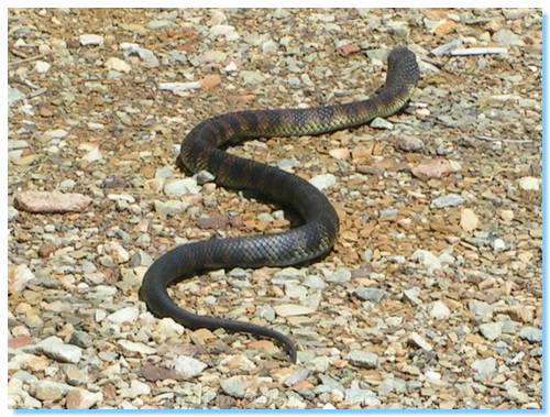
We passed a Tiger Snake on Moroka Road, who quickly made his way into the scrub at the roadside as we sat in the car watching him, and we then made a short stop while Henric readjusted the load of logs we collected from the first campsite. The logs were proving to be a little troublesome.
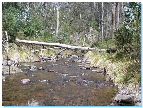
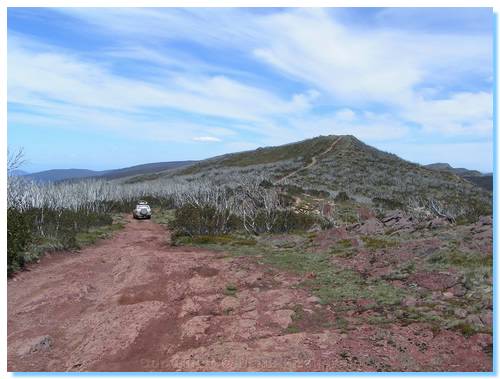
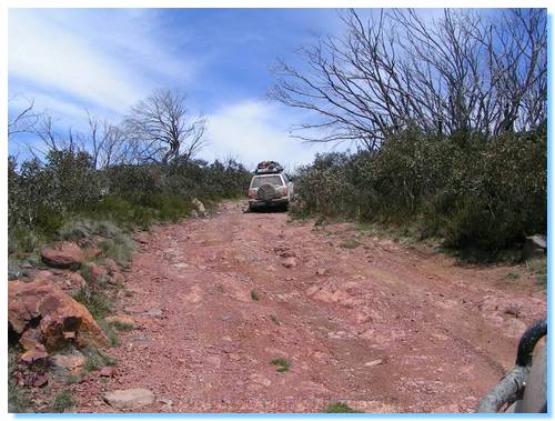
From McFarlanes Saddle we turned off Moroka Road onto Mt Wellington Track. The road meandered down through newly regenerated forest from previous years logging and crossed a small crystal clear creek before winding up the base of Mt Wellington.
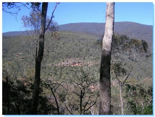
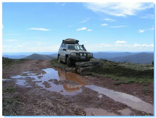
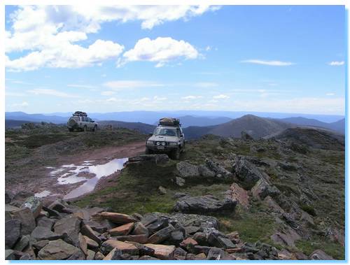
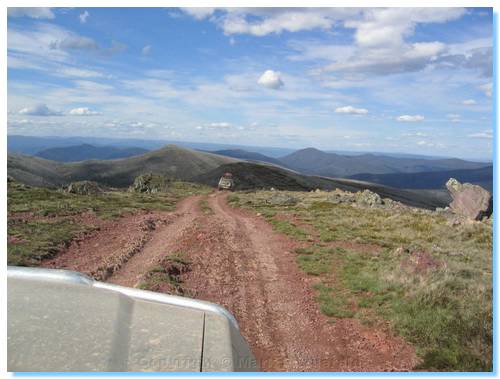
The time was passing quickly, and the reality of an early arrival at the campsite was at best most unlikely. The trip across Mt Wellington was however worth every second. Again, that pink hued rock was everywhere; both on the tracks where we drove as we climbed to Wellington's Peak, as well as in the weathered rocks at the sides of the track.
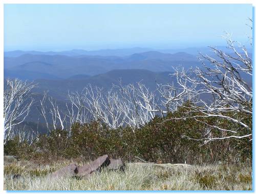
The views from the summit were endless, with azure blue sky with brilliant white clouds fading into distant hills of multiple shades of blue. We spent quite some time enjoying the summit; Henric even trying out a little rock climbing!
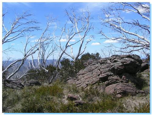
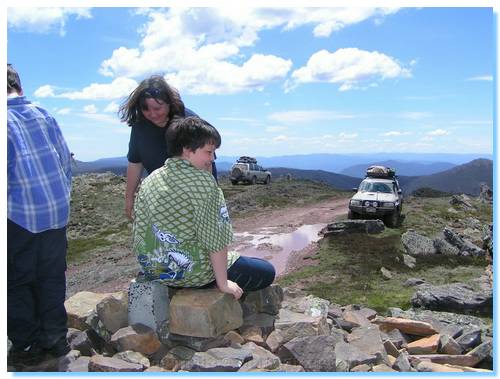
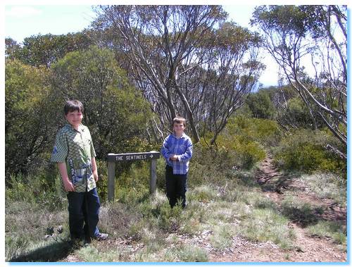
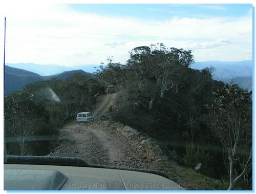
We decided to continue on to the Sentinels, given that we were pretty well mostly there and it was unlikely we would be making the trip across Mt Wellington for a long time to come. The journey to the end of the track near Gables End took us past Miller's Hut with a few fewer logs on the top of Henric's car, and one too many on the car bonnet. We eventually arrived at the start of the walking track to the Sentinels, where we set up for a late lunch.
Liam managed to catch himself a giant grasshopper, and the boys and Michelle stayed at the carpark to try out some watercolour painting while Cory, Henric and myself set off on the short walk to the Sentinels.
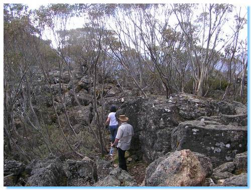
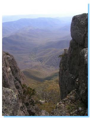
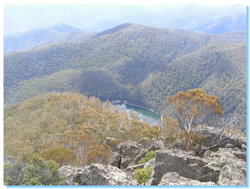
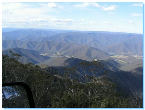
The walk was reasonably easy, with a little scrambling over rocks after we had dropped down into the saddle. The last part heading out onto the Sentinels was quite heart-thumping, with rock crevasses with sheer drops and magnificent views down to Lake Tali Karng; very much worth the walk!
With a long way still to go to the campsite, and the afternoon quickly escaping us, depsite the overnight introduction of Daylight Savings, we retraced our steps across Mt Wellington. We did afford the luxury of visiting Miller's Hut before continuing across the summit back to Moroka Road.
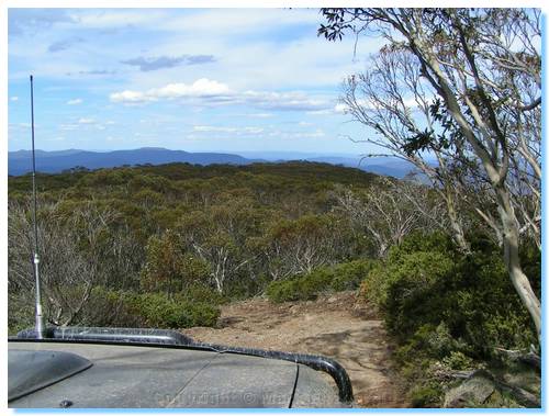
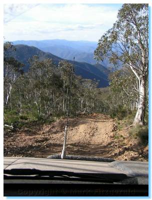
We raced along Moroka Road through some very beautiful treed alpine countryside, bypassing the Pinnacles which we had seen on our previous trip, due to time limitations. We were soon at the top of Billy Goat Bluff Track, one of the famous must do tracks of this region. The track appeared graded since our last visit a couple years ago, but was still a thoroughly enthralling drive with some really steep sections and endless and unforgettable views down into the Wonnangatta Valley. The track descends from the great heights of the Moroka Plateau into the Wonnangatta Valley in a relatively short distance and was just as enjoyable travelling down as it was a few years ago driving up.
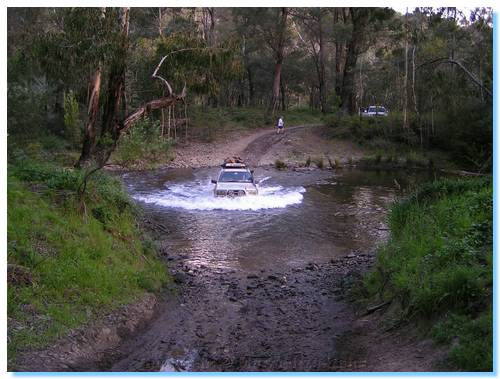
After much downward travelling, we arrived at the Wonnangatta River, which we followed downstream to Kingwill Bridge. The road to Talbotville closely hugged the impossible space between the cliffside and the Wonnangatta River then rolled across the gentle hills near the old Crooked River School site, and then following the course of the Wongungurra River where we had the first of many river crossings to reach our camp.
We crossed the Wongungurra River at least four times before branchng off and following the Crooked River further up the valley. There were 2 more river crossings over the Crooked River before we arrived at Talbotville, which we dubbed Tent City.
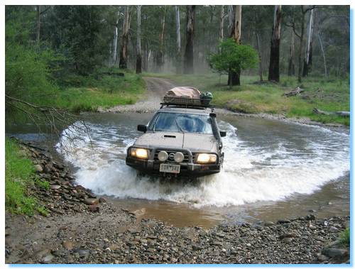
The place was crowded so we continued up the Crooked River in search of a quiet private campsite with river access.
We were starting to get quite desperate as darkness was falling and each small campsite along the river was already taken. Henric guarded the most promising of the poor pickings as we continued further upstream ever hopefull. There was a great crossing of the Crooked River where the exit track had actually become a small rivulet, but our mission beckoned.
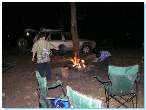
Finally, with only moments to spare and little river still ahead of us we found a very nice empty campsite just past Bulltown. We called Henric over the radio to abandon the site he was "holding" and we set-up camp and sat down to Spaghetti Bolognaise for dinner.
| Track Name | Surface | Travel Time | Total Distance | Avg Speed | Min Alt | Max Alt |
| Rumpff Flat to Licola | 2WD Gravel | 1 hour 2 minutes | 28.8km | 28km/hr | 208 metres | 641 metres |
| Licola to Arbuckle Junction (Tamboritha Rd) | Highway/2WD Gravel | 45 minutes | 46.7km | 62km/hr | 213 metres | 1485 metres |
| Arbuckle Junction to Wellington Tk exit(Moroka Rd) | 2WD Gravel | 22 minutes | 17.4km | 48km/hr | 1281 metres | 1499 metres |
| Wellington Tk (to summit) | 4WD | 35 minutes | 7.6km | 13km/hr | 1195 metres | 1652 metres |
| Mt Wellington summit to The Sentinels (Wellington Tk) | 4WD | 45 minutes | 9km | 12km/hr | 1385 metres | 1652 metres |
| Wellington Tk exit to Billy Goat Bluff exit (Moroka Rd) | 2WD Gravel | 25 minutes | 22.7km | 55km/hr | 1054 metres | 1275 metres |
| Billy Goat Bluff Tk | 4WD, some steep descents | 35 minutes | 8.3km | 14km/hr | 1416 metres | 328 metres |
| Kingswell Bridge to Talbotville (Crooked River Tk) | 4WD, numerous river crossings | 41 minutes | 14.9km | 22km/hr | 249 metres | 311 metres |
| Talbotville to Bulltown (Crooked River Tk) | 4WD, numerous river crossings | 36minutes | 7.4km | 12km/hr | 295 metres | 384 metres |