
Alpine High Country March 9th, 2003
The purpose of this trip was to drive through the High Country of Victoria, and get some appreciation of the extent of the damage caused by the January/February 2003 fires that have burnt over 1.1 million hectares.
I picked up Mark at 7:00am and headed up the Hume Freeway to Wangarrata.
We then made our way towards Bright. There were quite a few cyclists on
the rail trail into Bright, and we could see the hills had seen some fire, with
swathes of brown through the normally green eucalypts around Mt Buffalo.
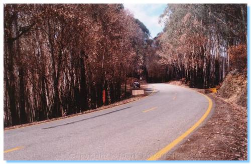
Bright itself was teeming with people. We had a morning tea of sausage rolls from the Bakery, then continued our journey to Harrietville. Very soon after making the steep climb up the Alpine Way out of Harrietville, we could see close up the effects of the fire. All of the undergrowth was burnt, as well as the sides of the trees. The trees themselves mostly still had their leaves, however these had turned to brown. There were new leaves shooting from the sides of the trunks on most trees, and green grass and ferns were coming up from the ashes. A number of the road signs had scorch marks, and some of the signs were buckled and had blistered paint, but the bush looked like it was already starting to recover.
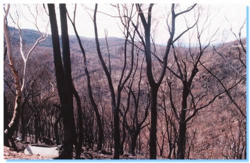
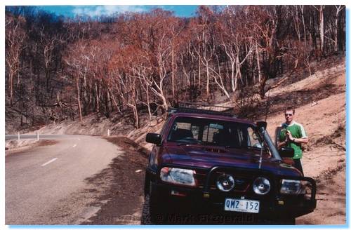
As we approached Mt Hotham, we were able to see across the valleys and get a better idea of how far the fire had spread. Mt Hotham itself also seemed to have had a pretty close call with the fire. We travelled through Dinner Plains, and the story was the same, burnt tundra and some damage to the trees. The closer we got to Omeo, however the worse it became, as the pictures attest.

We drove back via the Bogong High Plains Road, stopping at Wallace's Hut to break the drive. We then travelled through Falls Creek, and stopped for afternoon tea in Mt Beauty. A quick fish at Mongan's Bridge, and then the long trip home was started.
It should be noted that the best way to make a long trip into a longer trip is to take a shortcut. Wanting a different route to the freeway all the way back, it was decided to take a shortcut from Myrtleford down past Lake Buffalo, through Whitfield, Mansfield and back home. This would have probably worked OK if the road across the dam wall at Lake Buffalo was open, but it wasn't. Looking at maps there seemed to be a way through the bush on the Eastern side of Lake Buffalo, so after much exploring and backtracking we eventually found our way out of the dark forest at Dandongadale where we could then head on home through Cheshunt, Whitfield and Mansfield.
Though this short cut added an extra 3 hours or so to our trip, it could certainly not be called boring. We also spotted a good collection of wildlife, including a Tawny Frogmouth, numerous wallabies and kangaroos, a few wombats, including a mother and baby. And, unfortunately, a number of foxes and rabbits. The road between Dandongadale and Cheshunt was the most prolific in regards to animals spotted.