
Eildon & Darlingford 23rd February 2003
This was an exploratory trip to see how low Lake Eildon was, and also to see some of the old ruins that may have been uncovered by the receding lake waters.
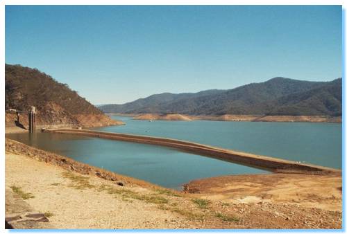
I drove up to Eildon Dam where the original dam, Sugarloaf was quite exposed. A 4WD access boat ramp had been constructed since the last time I was here, which allowed easy access to the old dam wall and also to drive around Point Dethridge.
I now wanted to go and see if I could find the site of the old town Darlington. The town was located at the junction of Big River and the Goulburn, and was dismantled with the construction of the dam before it was flooded. I had a rough idea of it's location, but had no idea if I would be able to find the track down or what I would find.
I turned off the Jamieson Road at Dry Creek Gap onto Jims Track. Jim's Track was a very good and clear 4WD track. This brought me down to Mallet Track, which is pretty much a 2WD track. I crossed the ford and proceeded along Taylors Creek Track, also a 2WD road.
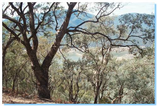
I turned into Wombat Track, a easy 4WD track with some steep sections that follows the top of the ridge. Coming over one peak, I saw a Lyrebird glide down the track in front of me, it's tail trailing behind. I missed the turnoff into Rhonda Track, and followed Wombat Track as far as I could go until I was stopped by a fallen tree, which looking at the map would have been close to the end of the track in any case. Wombat Track has also been realigned to that shown on the VicMap, now running along the next ridge to the East.
I retraced my steps and turned down Rhonda Track. This was another good quality track across the top of a ridge with great views down into the valley of Big River, far below. Soon I began catching glimpses of the Waterford Bridge across Big River, but I wasn't able to see the track I believed would led me down to the town site.
I continued down Rhonda Track, driving over a couple of trees blocking the track and followed the track East on a section not shown on the map. This track continued until a washout below the high water line. I parked the car, and decided to try a little fishing on the lake. I wasn't expecting to catch anything, the day was very hot and the trout had more sense. I returned to the car and headed back up Rhonda Track looking for the track down to Darlingford.
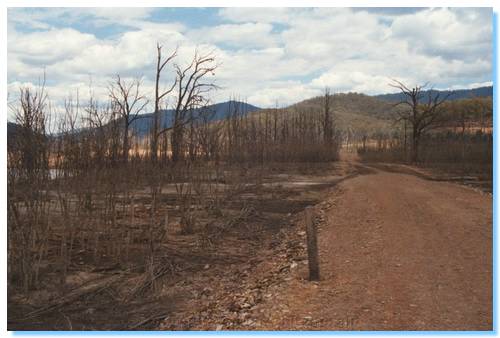
I eventually found what could possibly be a track heading off down the side of the ridge. Further exploration showed it was a track, though not one that had been used in a very long time. Following the track using best guesses at some times, I came out at a cleared area, and could see the Darlingford Bridge. I walked along what must have been the main road of the town; a few signs of where buildings once stood, such as the remains of chimneys and rusting iron were seen amongst the dead trees.
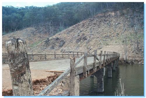
I walked out along the Darlingford Bridge, which on crossing the Big River was blocked by a landslip. The road could be seen in parts continuing to the left, North along the slope.
I walked back through the remains of the town, and could see fence posts, an old water tank tower, more chimney remains and an old bed!
I also found what might have been an old shed; a simple frame of tree branches with old shoes lined up inside! Out the back of the frame was part of an old engine block, which looked like it was originally hooked up to a belt but I couldn't see what it might have been used for.
Here's a web page I found with a number of photos also of the Darlingford town.