
Cambarville - Wolfram Mine 28th June 2004
Another trip into the forests of Marysville in search of the ever elusive Wolfram Mine. Did we find it? Read on...
We decided to tackle Mt Strickland via Strickland Spur Track, a reasonable challenge when there had been light rain. The track varied from slippery mud at the base to broken rocky ground on the ascent. A small tree across the track slowed us down for a little while, but it was easily cleared with the drag chain.
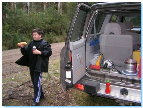
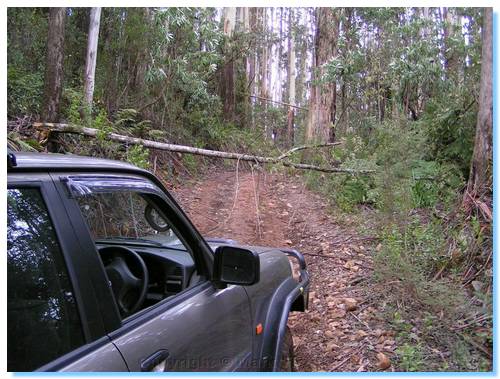
We continued across Mt Strickland and along MMBW Boundary Road to the turn off for Wilkes Creek Rd. Wilkes Creek Track appeared blocked by a number of young Mountain Ash having been blown over across the track, so we decided to have lunch before progressing any further. Lunch was an easy Hot Dogs on fresh tasty buns from Healesville. Nice and warming on such a cold day!
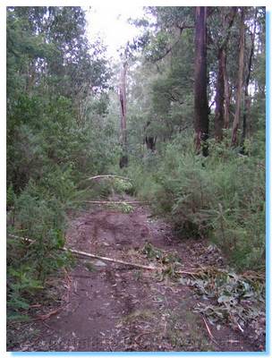
We started driving down Wilkes Track, but after driving over the 2nd tree across the track, and still more ahead I decided it best just to walk down and explore. We'd bought a machette on the way up, but they don't sell those things pre-sharpened so it wasn't much use for searching through the thick scrub.
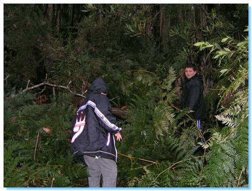
We spent quite a time exploring around off the side of the track looking for the mine, pushing our way through the underbrush on the steep hillside.
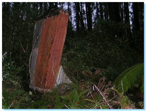 We found the remains of an old hut, the corrugated iron still visible but the wooden floor well rotted away. From our map this was a good indication of where the mine should be, but the Wolfram had eluded us again for what must have been the fourth time! The only way we will be able to find it is either a bush fire travelling through the area, or finding somebody else who has found it previously that can give us specific directions.
We climbed the steep track back to the car and continued along MMBW Boundary Road, passing the proud owners of a new logging truck, who had stopped on the road and taking photos.There was a bit of snow along the track as we passed Mount Grant and joined the Marysville - Woods Point Road.
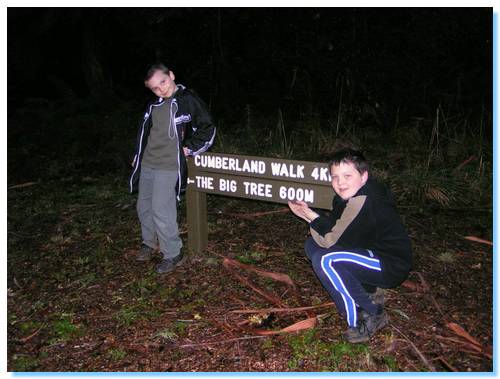
We parked in the car park for the Big Tree near Cambarville and commenced our walk, soon coming to a clearing where the home of the Hermit of Cumberland had been in the early 1900's. A plaque marks the site of his hut, and tells the story of a visit to the Hermit by the Governer of Victoria in the late 1920's. The Hermit, George Loch took the Governer to visit the Big Tree, where the Governer Baron Somers remarked "Magnificent! I wonder how long it's been here." To which George replied "Buggered if I know Mr Somers, it was already here when I came along."
The path continued on through the other side of the clearing and descended gently through a ferny gully and across a wooden bridge over a clear stream. In the distance the tall slender treess could be seen gently swaying back and forth in the breeze.
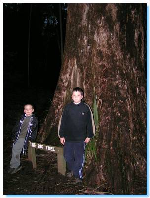
We soon arrived at the Big Tree, which isn't so much big, especially when compared to the Ada Tree, but is extremely tall, and is the tallest in Victoria.
The sign near the tree puts it at 84 metres tall, with a girth of 5.2 metres at 3 metres off the ground. A wind storm in 1952 broke the top off this tree and many others in this group of "Tall Trees". The Big Tree's original height prior to the storm was 92 metres.
I found a web page today that had a PDF of a Study by the DNRE on various Mining relics and sites in the St Andrews Mining Division. What a treasure chest! It has GPS co-ordinates of various mining sites as well as listings of various artifacts that can be found there. And of course if has GPS co-ordinates of the Wolfram Mine! Plotting it onto the map, it actually appears to be on the western side of the road, and not the eastern side as I had expected from the VicMap. So, we will be off for one more final time to find the mine site.
Read about the previous attempts to find this mine here