
Wolfram Mine 12th September 2004
After some research that gave me some clues to where this elusive mine was, we decided on an impromptu trip back into Marysville, with all hopes raised that we would actually find the mine this time. I'd found a DNRE report on various mines and mining relics in the Yarra Valley Area, and it had GPS references of the mines, including the Wolfram Mine. The co-ordinates were given only in 3 places, so the accuracy was +/- 70 metres, but I was ever hopeful.
There had been quite a bit of rain over the weekend; all of the paddocks through the Yarra Valley were flooded, which was a nice change from all of the drought we had experienced in the preceeding years. We did a quick stop at an orchard on the way up through Coldstream, and picked up some very delicious and juicy Fuji apples. We stopped in Healesville for some supply shopping then headed on over the Black Spur, which had snow cover. We stopped for lunch at the Bicentennial Trail Campground off the Anderson Mill Road. It was a little chilly, with some recent snowfalls. The kids found a huge earthworm, about a foot long when stretched out!
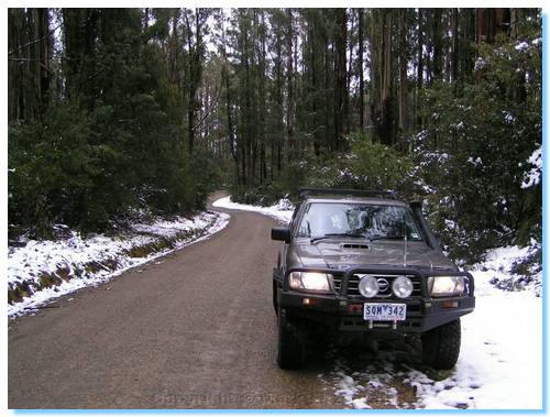
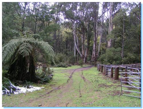
We'd already bypassed on Strickland Spur Track, given how wet it was, and also had given Strickland Link Track over for another day, and judging from the snow at the campground, which was at an altitude of 560 metres, it seemed like the right choice. We kept to the main forest roads, which soon became covered in a light snow as we climbed up Mt Kitchener and aross Paradise Plains.
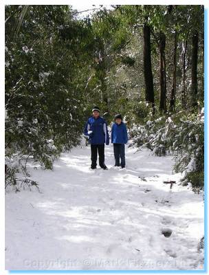
Wilkes Creek Track was covered in snow, and knowing how steep it was further down, we left the car at the top and walked. Best to be safe since we were travelling alone. We weren't too far down the track when we heard the sounds of 4WDs climbing towards us. Two cars passed us climbing up; they'd left the third of their convoy at the bottom of the steep climb, unable to get up the slippery track.
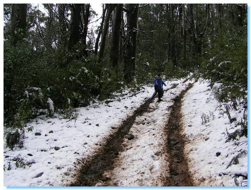
They returned with a shovel to try some track building, but eventually snatched the remaining car up the track and out. The guy had already slipped down the track on his earlier attempt, so we were quite glad we'd left our car up at the top and walked. The walking had proven tricky enough with the kids having fallen over a couple of times, much to their amusement.
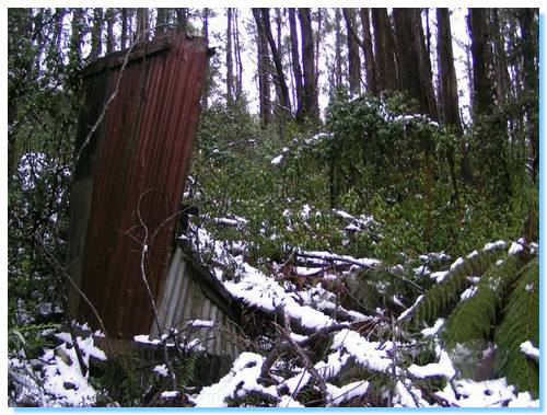
I'd passed the point marked on the GPS with no sign of the mine, and continued walking down to the hut ruins we had seen previously. Even with a nice sharp machette, there was no way to explore any distance into the bush. The hut was about 220 metres north of the expected GPS point, so I wonder if the datumn was wrong. Giving up looking around the hut, we continued slowly back up the steep slippery hill, and searched further at the expected GPS point. But nothing but thick snow covered bush could be seen. The GPS was indicating the mine was 30 metres off to the east of the track, in what looked like a small clearing. But it may as well have been 300 metres. Again, we had tried and failed. Dejected and tired we returned to the car.
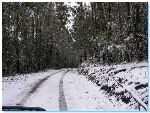
We followed our previous trip down along MMBW Boundary Road, which was covered in snow and quite scenic to drive along. We returned home via Marysville for a cappucino.
Our previous attempt at finding the Wolfram Mine is documented here.